
Bryant Previous Residents by Era
An address history starts with the source nearest the date being studied. Current assessment data identifies the parcel and assessment owner. Deeds carry ownership back by named parties and legal description. Those ownership records do not list each person under the roof, so census, obituary, news, and any confirmed reverse-directory entry supply the household layer. The exact online start for Saline County deed images was not published, and DataScout states that deed images are unavailable in its county snapshot. A blank web result must therefore send the search to the recorder, not end it.
| Source | Verified span | Bryant-area keeper | Evidence supplied |
|---|---|---|---|
| County deed books and indexes | County formed in 1835; exact series require clerk confirmation | Saline Circuit Clerk and SCHHS | Owners, transfers, and legal descriptions |
| Assessment and tax portals | Current roll and portal year choices; oldest year unstated | Assessor, Collector, DataScout | Owner, situs, tax mailing, values, and receipts |
| County imagery | 2013 and 2015 through 2026 | Saline EDGE GIS | Visible site and structure change |
| Federal census | Decennial schedules through 1950 | NARA, library, and FamilySearch | Occupants, kin ties, and dwelling order |
| Obituary index | 1930 to present | Saline County Library | Death notices and family links |
| Reverse directories and Sanborn maps | No Bryant run or edition verified | Ask local library, SCHHS, and state archives | Possible address listings or building detail |
Begin with the parcel even when the goal is much older. Its legal description provides a stable key for the recorder. For a twentieth-century household, pair that key with census dwelling order and local news. Staff must confirm whether a regional Benton, Little Rock suburban, telephone, or criss-cross volume includes Bryant for the desired year.
Bryant Parcels Start the Trail
The current DataScout Saline County snapshot is a practical first stop. Search by a Bryant address, then save the parcel or PPAN, situs address, assessment owner, mailing address, legal description, subdivision, lot, block, sale reference, and roll date. Situs means the physical property address. The mailing field is where the tax notice goes. It may point to the owner, an agent, a business, a post office box, or an old address, so it cannot prove residence.
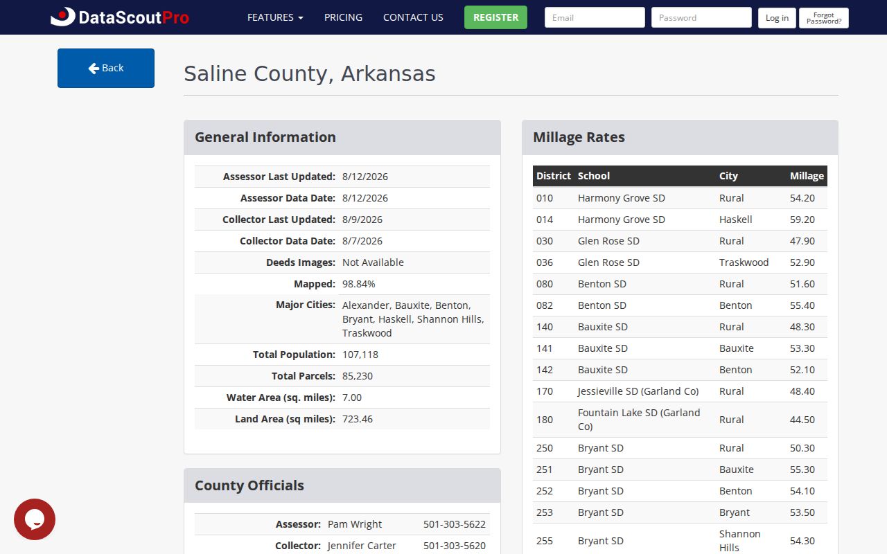
The county snapshot also says deed images are not available there. Treat sale references as leads to the official recorder record. This keeps previous residents research from confusing a contractor's parcel display with a recorded conveyance.
Confirm that the situs falls inside Bryant with parcel and city maps. A Bryant mailing label or school district name can extend beyond municipal limits, while the deed history remains at the county level. That distinction explains why a parcel may have years of Saline County records before it first appears in Bryant permit or ward files.
Saline Deeds Track Past Residents
The Saline County Circuit Clerk is also the ex officio recorder. That Arkansas arrangement matters because there is no separate register of deeds to find. The office at 200 N. Main Street in Benton keeps deeds, mortgages, releases, liens, plats, surveys, and other land records. Start with the current vesting deed and move backward through named sellers and buyers while matching the legal description at each step.
- Copy the current owner, parcel ID, legal description, and deed reference from the assessment record.
- Ask for the purchase deed and note its grantor, grantee, execution date, recording date, and book, page, or document number.
- Search the seller as a prior buyer. Confirm that the same land description passes through the next deed.
- Repeat the link. When online clues stop, call 501-303-5615 and use the Benton counter and deed books.
- Keep ownership evidence separate from census, directory, and obituary evidence of actual occupancy.
- Grantor
- The party who transfers an interest in land.
- Grantee
- The party who receives that interest.
- Chain of title
- The linked set of recorded transfers for the same land.
- Legal description
- The lot, block, subdivision, or survey language that identifies land more firmly than a street label.
There is no verified public online cutoff year for this deed index. Do not print a guessed date. A focused request naming the party, date range, legal description, and known book or page gives recorder staff a far better target.
Bryant Address Keys Stay Stable
Street text can change while the land does not. Bryant's growth, annexation, new subdivisions, and corner parcels make lot and block references more durable than a typed address. For an older rural-edge tract, the key may be section, township, range, or metes and bounds. Use the assessor and GIS to translate that text before following a deed. A recorded plat can also show the lot order, roads, common areas, and the name of a subdivision.
Permits and annexation papers add dates, but they play supporting roles. A city file can show when a project entered Bryant's permit, ward, or zoning system. It does not replace the county title chain. If a needed permit register or annexation file is not online, request the existing address file from the Bryant custodian under the Arkansas Freedom of Information Act. Ask for a defined address and date span rather than asking staff to create a new history.
Note: No authoritative Bryant-specific Sanborn edition or reverse-directory year run was found, so local staff must confirm holdings before a visit.
Bryant Previous Residents in Census
Deeds identify owners. They leave out many people who lived at an address. The newest public federal population census is 1950, and its household relationships, dwelling order, ages, birthplaces, and other fields can place a family near the property. The Saline County History and Heritage Society has census transcriptions for 1840, 1850, 1860, 1870, 1880, 1900, and 1920, plus a 1910 index arranged both by name and by dwelling. That dwelling arrangement is especially useful when a modern street key did not yet exist.
A careful household process keeps source roles clear:
- Anchor one person and address in a dated deed, tax record, notice, or confirmed directory entry.
- Check the nearest public census by name, enumeration district, and dwelling order.
- Compare household members with the prior and next census, while allowing for moves and name changes.
- Use newspaper, school, cemetery, and obituary evidence to move between long census gaps.
- Return to deeds only for ownership. Do not assign every deed party to the household.
The actual shelves and regional catalog strategy are covered on the Bryant city directory page. Absence from one edition can reflect a skipped canvass, an unlisted telephone, rural routing, annexation, or a volume that did not cover Bryant.
Bryant Imagery Dates Change
Saline County GIS services list imagery for 2013 and each year from 2015 through 2026. That visual sequence can help date a new roof, addition, cleared lot, road shift, or new building when a permit index is thin. It cannot name previous residents. Nor does an image prove the precise completion date of work. Compare it with permit dates, assessment improvement facts, and recorded deeds before drawing a conclusion.
The Arkansas court Build Initiative shows a separate modern records transition that matters when probate becomes part of a house trail.
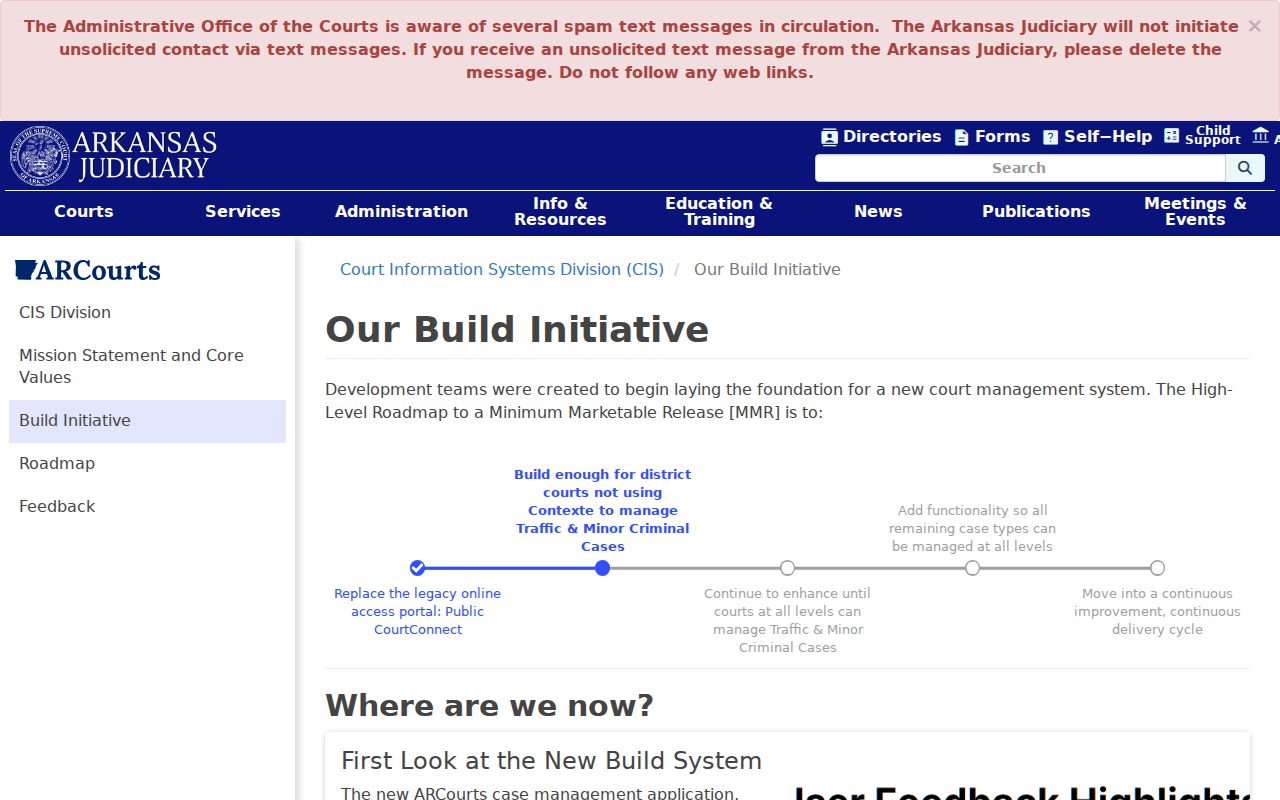
Search ARCourts remains the public starting point while court systems evolve. When an estate case appears, use its case number to request the public petition, order, or deed-related document from the clerk.
Bryant Obituaries Close the Trail
The Saline County Library genealogy resources include a local obituary index from 1930 to the present, arranged by surname and death-notice date. A notice can connect a deceased Bryant resident with relatives, a congregation, a cemetery, or another town. Treat those names as reported family clues. Then confirm death, probate, cemetery, and any estate conveyance through their own records.
The Mabel Boswell branch at 201 Prickett Road provides a Bryant starting point. SCHHS in Benton adds manuscripts, photographs, family files, funeral-home material, public-record transcriptions, and local publications. For a former resident, send staff the name variants, exact address, and date range. That gives the archive a real search key and avoids a broad request for conclusions.
Note: Ashby Funeral Home transcriptions cover 1916 through 1928 and may bridge deaths before the library's modern obituary index begins.
Saline Archives Survived Offline
Saline County offers a rare and useful house-history lesson. SCHHS reports no courthouse fire and describes the county's records as virtually intact, though neglect caused some loss. Missing web images therefore point more often to an access, catalog, or digitization gap than to wholesale destruction. Since Saline County was formed in 1835, early Bryant-area research can reach county-formation records, while an older land trail may continue into Pulaski territorial material or federal land patents.
That story changes the fallback. Ask for grantor and grantee books, deed books, tax volumes, plat books, census transcriptions, and will indexes. Do not search only the present street number. The courthouse and SCHHS are both in Benton, while the Mabel Boswell branch is in Bryant. Grouping those stops can make an offline search much more efficient.
Bryant Deed Alerts Need Context
Saline County publicized new deed and notary fraud safeguards in 2025. The local deed-protection report describes name monitoring and the new recording measures.

A recording alert is notice that a name appeared in a filed instrument. It is not proof that the document is valid, title insurance, or a full chain of title. Verify any surprise filing with the Circuit Clerk at the published number.
A second Saline County alert-system account gives more context on notary monitoring and the local response.
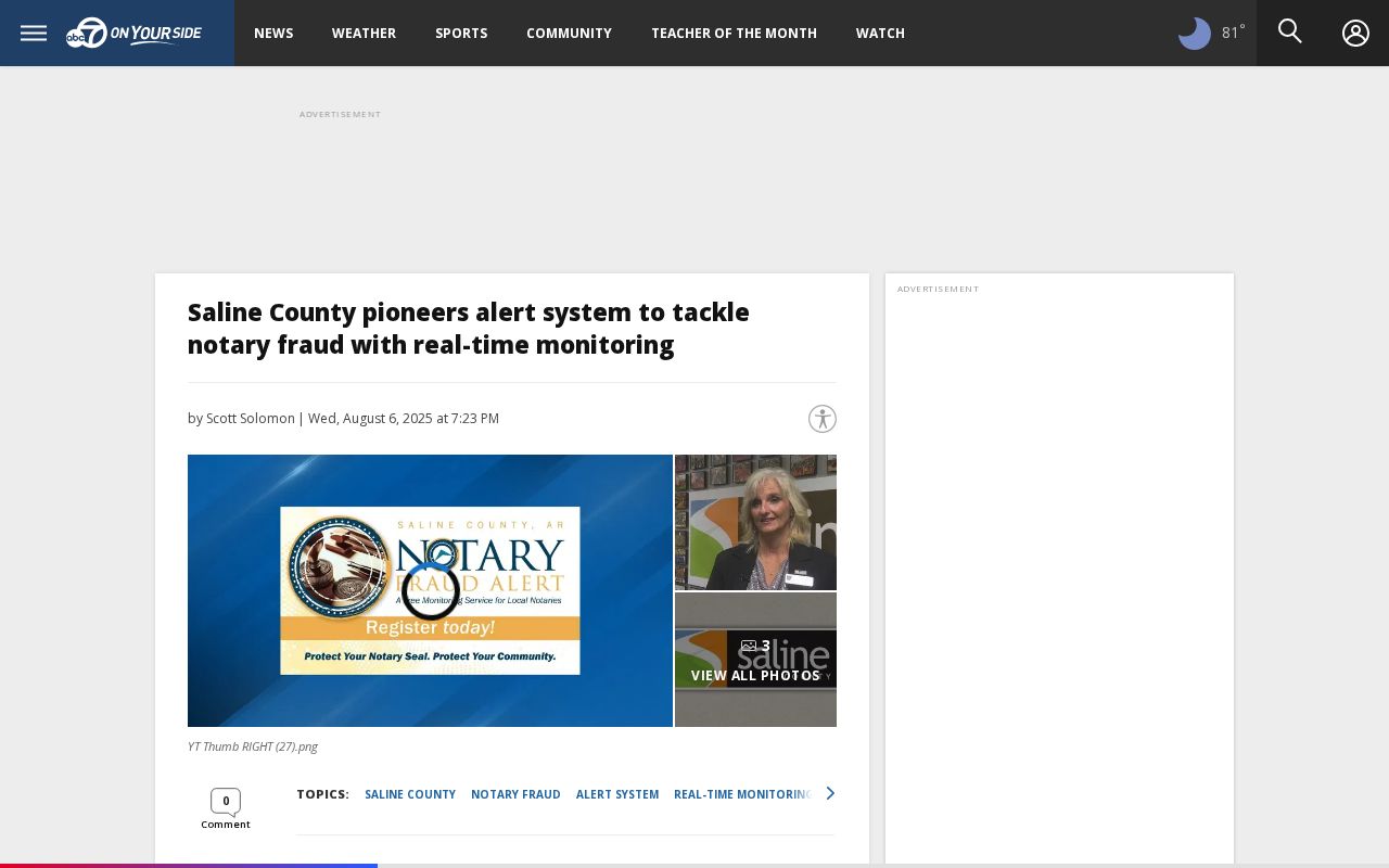
For address history, these alerts are a prompt to inspect the actual instrument. Never insert an alert into the ownership chain without reading the recorded deed and matching its legal description.
Bryant House Research Limits
Previous residents research must preserve the line between ownership, occupancy, and a passing connection. An assessor card names an assessment owner. A deed records a transfer. A census or directory reports a household at a point in time. A permit names an applicant or contractor. An obituary reports family and community ties. None can stand in for all the rest, and no public source lists every person who once stayed at a Bryant address.
Protected addresses, sealed files, utility customer records, library-user records, and motor-vehicle addresses are not ordinary public sources. Stop when a custodian suppresses information. For an inaccurate public entry, seek correction from the office that owns it rather than spreading it through other files.
Lawful use. Research who lived here before for house history, genealogy, estate work, or personal curiosity. Never use a record trail to watch, harass, threaten, or harm a living person.