
Walk a Bryant Street Directory
A street search works best as a chain, not one broad query. Saline County records can name an assessed owner, map a parcel, and document a transfer. Bryant records can add permits, zoning, and annexation facts. Historical sources may name a listed subscriber or household at an earlier date. These roles differ. An assessment owner is not proof of every person who stays at the site, and a permit applicant may be a contractor. Keep the source and its date beside each name.
- Normalize the street number, direction, name, and suffix. Search the same form with and without a direction if the first attempt fails.
- Run the address through the Saline tax search. Save each parcel number, situs, owner display, mailing address, and legal description.
- Open county GIS. Click parcels in order along both sides of the road, including corner parcels that may use another street as their situs.
- Take the owner and legal description to the Circuit Clerk. Search the owner as grantee, meaning buyer, and follow the deed to its grantor, meaning seller.
- Check lawful voter, permit, newspaper, census, and confirmed criss-cross sources for evidence about people rather than land alone.
The result is a Bryant street directory with honest labels. It distinguishes a current parcel card from an old deed, a mapped site from a mail contact, and a named person from a proven occupant. When a project narrows to one historic volume, the Bryant city directory collections explain how to inspect that shelf without assuming a complete local run exists.
Search Bryant Streets by Tax Fields
The Saline County tax search is the most direct address form captured during local research. It accepts more than a street line. A surname, tax year, parcel number, school district, receipt date, and status control can refine a match. The Address field may behave as a property or mailing search on a given result, so inspect the returned labels before drawing a conclusion.
| Search control | Input | Required | Useful Bryant clue |
|---|---|---|---|
| Last or business name | Text | No | Owner or taxpayer display |
| First name | Text | No | Refines a surname |
| Address | Text | No | Test situs and mailing behavior |
| Tax year | Dropdown | No | Portal-supplied years only |
| PPAN or parcel number | Text | No | Stable parcel key |
| School district | Dropdown | No | Includes Bryant district choices |
| Active property | Control | No | Restricts record status |
The captured form shows why this tool leads the address chain. View the official Saline tax-search screen before comparing it with the image.
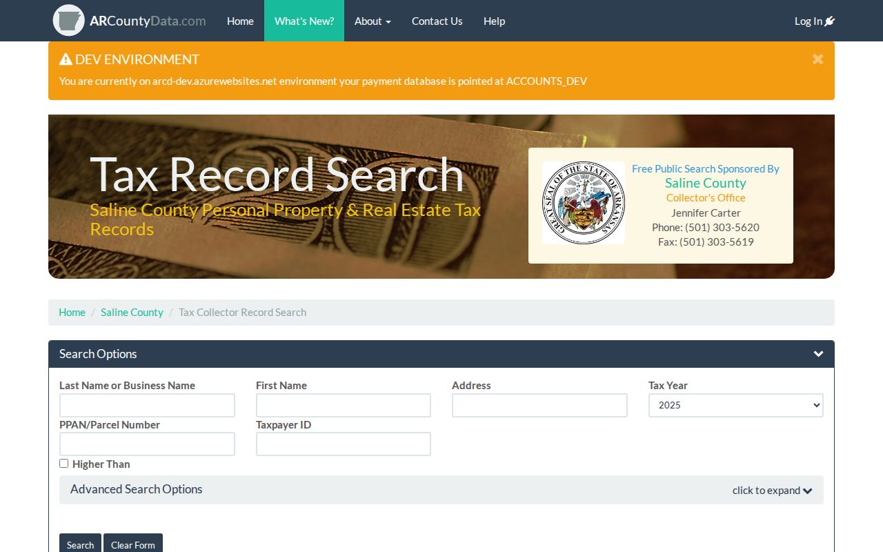
The screen confirms a field-based search surface, while the result labels still control whether a returned address is the land site or the tax destination.
Bryant Records Arranged by Street
No Bryant office maintains one complete occupant list. Address evidence is split among the assessor, GIS, recorder, collector, city planning files, and restricted election records. A sound Bryant street directory uses each set for its stated role. The online portal is only the first channel. County phone and counter service, a focused Arkansas Freedom of Information Act request, and the library or historical society remain important when the web trail ends.
| Address record | Local keeper | What it supports | Access route |
|---|---|---|---|
| Assessment and tax | Saline Assessor and Collector | Owner, situs, mail, parcel, tax year | Portal, phone, counter, focused request |
| Parcel map | Saline Assessor GIS | Geometry, adjacency, imagery | EDGE or ArcGIS services |
| Deeds and plats | Circuit Clerk and recorder | Transfers and legal land identity | Benton counter and deed books |
| Permits and zoning | Bryant Planning | Project, applicant, dates, city status | iWorQ, city files, records request |
| Voter material | Saline County Clerk | Limited registration evidence | Personal lookup or lawful custodian request |
| Older name sources | Library and SCHHS | Subscribers, census households, notices | Database, branch help, research center |
The parcel number links the assessment to GIS. The legal description then links the land to deeds and plats even if street text changes. City files add context only after municipal jurisdiction is confirmed. Historical sources shift the question from ownership to people named at a place.
Note: Saline County's online recorder cutoff and copy fees were not verified, so call the Circuit Clerk before relying on a web-only search.
Bryant Situs and Mailing Clues
Two address fields can point in different directions. A situs address is the mapped place of the parcel. A mailing address is where the tax notice goes. Matching values can support an owner-occupancy clue, especially when an exemption flag appears, but they do not name every person present. A different mailing value might be another residence, an office, an agent, or a post office box. It is contact evidence, not automatic proof that the owner moved.
- Parcel
- A county assessment and map unit identified by a parcel or PPAN number.
- Situs address
- The street location assigned to the land or improvement for map and tax use.
- Plat
- A recorded drawing that lays out lots, blocks, roads, and common areas in a subdivision.
- Criss-cross directory
- A volume ordered by street and house number, often listing a subscriber rather than every person present.
Keep the legal description as a third key. Bryant subdivisions often use lot, block, and subdivision text. Rural-edge or older tracts may use section, township, range, or metes and bounds. That land description can remain stable when a road label, unit, or postal place does not.
Browse Bryant Street Parcels
The Saline EDGE and ArcGIS services supply the map half of a street search. Enter a known address, zoom until parcel outlines can be read, and click each lot along the chosen segment. The public controls may include a geocoder, identify action, pan, zoom, basemap or imagery choice, layer list, measure, select, and print. The exact public interface can change, so treat the map labels and current attributes as the live source.
GIS is good at adjacency. It catches vacant tracts, shared common parcels, multi-parcel sites, and corner lots that a text-only search can miss. It is not a legal survey. Parcel polygons are assessment and map aids, not a claim about a fence or surveyed line. County imagery lists 2013 and each year from 2015 through 2026, which can help date visible site change without proving who caused it.
The county numbers add useful scale. DataScout reported 85,224 Saline County parcels and 98.84 percent mapping when inspected. The scale and coverage make the parcel layer useful, but neither number turns the map into a resident census.
Chain Bryant Street Deeds
After the parcel card names an owner, the land trail moves to the Saline County Circuit Clerk. Arkansas combines the circuit clerk and recorder roles. Search the present owner as grantee to locate an acquisition. Read the deed for grantor, grantee, legal description, execution date, recording date, and document or book-page reference. Then search the grantor as an earlier grantee while checking that the same land description continues.
DataScout states that deed images are not available in its Saline County snapshot. A portal sale line is not the official recorded image. No authoritative source located for the research gave an online land-index start date. The dependable fallback is the recorder counter and the deed or grantor-grantee books at 200 N. Main Street in Benton. Ask for a known party, rough date, document number, or book and page, then ask about ordinary and certified copy prices.
See the Arkansas Judiciary circuit-clerk directory that identifies the local recorder before using the captured page below.
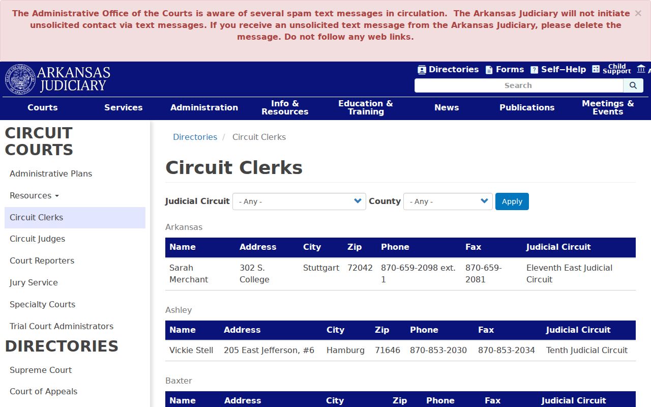
The official directory supports the Benton office and phone route that replaces an unsupported claim about a complete online deed screen.
Bryant Street Maps and Permits
County parcels answer where the land is. Bryant maps answer whether it lies in the city and how city records classify it. The city document center publishes ward maps, zoning maps, a planning-area map, a 2010 master street plan, and later transport maps. The Bryant zoning code also documents annexation records and required land descriptions. Those files explain why one parcel appears in county records long before it enters Bryant permit or ward records.
The Bryant maps and plans library should be read alongside the captured navigation screen.
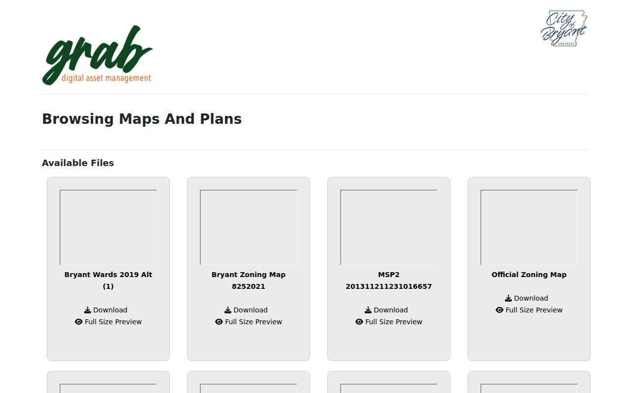
The image shows the municipal map route used to test ward, zoning, planning, and city-limit context apart from the postal city name.
Planning and Development also links iWorQ, permits, inspections, rezoning, subdivision review, and local business applications. A permit can name an applicant, contractor, project address, and dates. It cannot be treated as an occupant roll. If the portal does not expose the needed address file, request an existing permit or inspection record by address and date range under Arkansas FOIA.
Bryant Street Directory Boundaries
A Bryant postal label, Bryant School District assignment, and Bryant city boundary serve different systems. The school district reaches beyond municipal limits. County materials also separate Bryant millage from rural Bryant School District rows tied to Benton, Shannon Hills, and Alexander. For that reason, do not place a parcel inside Bryant from the address label alone.
Use USPS for delivery form, Saline GIS for the parcel, and city maps for jurisdiction. Check wards, zoning, school, voting, and fire districts separately. No documented Bryant-wide street renumbering year was found. Test spelling, road suffix, direction, former postal place, and corner-lot variants case by case instead of inventing a single renumbering event.
VoterView Is No Street Roll
Arkansas VoterView asks for first name, last name, and date of birth. It is built for one voter to confirm registration and polling information. It cannot be browsed by street, and it should never be described as a Bryant street directory. The result may support county, precinct, district, or registration facts for the person whose identifying inputs are known. It does not disclose ballot choices.
A separate voter-file request belongs with the Saline County Clerk and remains subject to election law, restricted fields, protected-address rules, and lawful-use terms. Even an approved file would omit minors, nonvoters, and suppressed entries. Historical poll books may be sought by county, township or precinct, and election year from the clerk, Arkansas State Archives, or SCHHS.
Note: Ownership alone does not establish electoral residence, and VoterView's identity gate prevents a parcel-by-parcel street sweep.
Older Bryant Streets Need Surrogates
No official catalog located in the research confirmed a Bryant-specific city or reverse-directory run, publisher, or exact year span. That gap must stay visible. Ask Mabel Boswell Memorial Library, the Bob Herzfeld Memorial Library, SCHHS, and the CALS Butler Center to check Benton, Little Rock suburban, telephone, and reverse-directory headings. A criss-cross book may list only a telephone subscriber. Absence can reflect a skipped canvass, rural route, unlisted number, or the volume's scope.
When no shelf volume exists, use the 1950 and earlier public census, SCHHS census transcriptions, its 1910 index by dwelling, the 1890 taxpayer volume, the Saline Courier archive, and the library's obituary index. These are dated surrogates, not interchangeable proof. Census dwelling order can rebuild nearby households. A taxpayer list speaks to a tax role. An obituary may connect relatives without giving an exact present address.
Limits of Bryant Street Records
Public ownership rolls do not list every person at a Bryant address. Utility customer data, library-user records, and motor-vehicle addresses are not ordinary public street sources. Protected voter addresses must remain suppressed. A deed proves a recorded transfer, an assessment reports its owner field, and a directory reports a listed person. None should be enlarged into a claim it cannot support.
Commercial address tools may merge stale or mismatched data. Official records are slower but name the keeper, record role, and copy route. Correct an error with the source office. Do not try to defeat a protected address by joining separate files, and do not publish personal details that are not needed for family history, property research, civic review, or a lawful effort to reconnect.
Lawful use. Bryant address records are for personal, lawful research. Never use a street search to stalk, harass, intimidate, or harm anyone.